
As a private market provider of professional utility locating and mapping services on numerous continents, I have been very fortunate to collaborate with organisations all over the world. Being a utility surveyor in a global market I have had the pleasure to mentor and train personnel in the art and science of utility locating and in the building of utility mapping programs that provide highly reliable 2D utility composite plans and 3D digital deliverables across a broad spectrum of industries. The exponential growth of the utility mapping industry has caused a transformation within the underground damage prevention industry and a growing acceptance and recognition of utility surveying as a dedicated discipline, one focused on mapping the underground with the same level of due diligence as land surveyors have practiced for hundreds of years. However, as subsurface utility mapping matures, so too does its governing codes, regulations, best practices, and technologies. Although Australia and North America have similar cultures and industrial practices, there are numerous differences in our utility locating and mapping best practices but also very similar challenges.
US 811 One Call System versus Australia Dial Before You Dig (DYBD) Programs
One of the biggest differences between the US and Australian underground damage prevention industries is in the respective government-sponsored programs in the process. In the US there is an 811 (One Call) requirement to call before you dig which is quite different from Australia’s DBYD program.
In the US, federal and state laws require contractors, homeowners and excavators to various degrees to pre-mark the proposed excavation limits with white paint and subsequently inform their respective state One Call center of their intent to break ground. The One Call ticket process across the US is standardised, thanks in part to the strong collaborations fostered by the Common Ground Alliance (CGA). There are, however, subtle regulatory differences among states, including in respective state statutes. The One Call ticket request requirement is to have every project contact the One Call center 24 to 72 hours prior to ground breaking. After the excavator pre-marks the site with white paint and notifies the One Call Center using either the online form or by a toll-free phone call, the One Call Center generates an electronic ticket based on a geographic location that is transmitted to all underground stakeholders in the proposed work area. These stakeholders are provided all the pertinent ticket information regarding the proposed excavation. The underground stakeholders can respond accordingly based on existence and ownership of facilities in the proposed work zone, potential utility conflicts, protection needs of critical infrastructure and risk associated with working on or near a particular facility. A current topic of conversation in the US underground damage prevention industry is the allowed exemption for some underground stakeholders. For example, municipalities, railroads and state DOT’s are typically exempt, though are allowed to participate on a voluntary basis.

3D Model of above and belowground mapping project
Once a ticket has been issued, each respective utility owner reviews the ticket information. If there is a known utility in the vicinity of the project a utility locator is dispatched within a specified period to locate the underground assets at no costs to the excavator or site owner. Sophisticated software programs are often used to query the request and dismiss tickets where there is no potential utility conflict. Some underground assets owners use their own in-house staff to respond to tickets and dispatch locators to paint and flag the location of underground facilities. The underground damage prevention professionals often rely on plans generated from digital GIS mapping to determine the location of facilities to be marked and, in most cases, use an EM locator to confirm the position of a facility that needs to be marked inside the work zone. In many instances underground asset owners engage contract locating firms to manage and respond to One Call tickets under privately negotiated contracts and rates.
In contrast to Australia, the typical US One Call Center does not maintain a depository of utility records, nor does it provide plans in hard copy or digital formats to designers or excavators through a third-party vendor. In the U.S. it is the responsibility of each and every project team to solicit the underground public and private stakeholders to provide a copy of the plans showing the locations of the facilities. The plans and records are sometimes provided at the utility owners discretion and often a printing fee is charged. In recent years many utility owners, particularly telecommunication line owners, have adopted a policy of refusing to provide plans and records, thus hindering facility owners and engineers in developing a complete existing conditions survey. In every US state the ticket must be renewed within a specified period, often 28 to 30 days. During this period, the excavator is required to coordinate with the respective underground stakeholders, respect the utility mark-outs and maintain health and safety program to protect workers from injury of death when exposed to high-risk facilities.
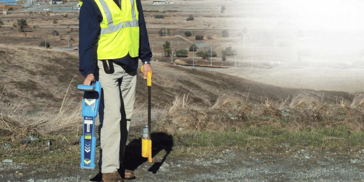
Utility Locating Equipment
There is very little difference between US and Australia when it comes to the utility locating equipment in use. In fact, given that most manufacturers of utility locating and remote sensing tools have a global presence, there are only subtle differences in instrumentation arising from the use of local vendors and their equipment support. As in Australia, in the US there is a significant extent of non-traceable buried facilities. Installations such as fiber optic networks and plastic water, sewer, drain, product and gas lines are all very common. In both countries the vast majority of these facilities have been buried without the benefit of tracer wire. Some US states have made it illegal to bury plastic and non-metallic lines without tracer wire but decades of poor decision-making and cost-cutting measures have made locating and mapping plastic underground facilities more time consuming, difficult and, in some cases, impossible.
While there may be very few differences between the two countries in the utility locating and remote sensing technologies, the non-destructive vacuum excavation market is very different. Hydro-excavation dominates the Australian market due to the speed and efficiency of high-pressure water nozzles in cutting through clay and highly cohesive soils. In the US, however, some governmental agencies do not allow hydro-excavation. As a result, the US has seen the adoption of both air- and water-vacuum systems, with much reliance on the air systems for small, site-specific keyhole excavations for subsurface mapping and for utility damage prevention programs. Large hydro-excavation systems are predominantly used in the US for slot-trenching and utility excavation work. In many parts of the US, air-vacuum excavation is the preferred solution. The adopted philosophy is that of a trade-off between the speed and efficiency of water on one hand, and a reduction of slurry waste and dumping charges on the other hand. It is recognised that there are significant costs arising from the transportation of both vacuum and hydo-vac spoils to licensed waste disposal facilities. For the most part, the US market accepts slower excavation speeds as it allows the dry excavated material to be screened and placed back in the exploratory test hole and avoid over-the-road travel time and lost work hours.

Boston Subsurface Utility Mapping from 1898
The Standard of Care for locating and mapping buried facilities
In 2003, the American Society of Civil Engineers published a guideline for the utility locating and mapping profession. This guideline is known as CI/ASCE 38-02 – Standard Guideline for the Collection and Depiction of Existing Subsurface Utility Data. These standards were well received from the beginning but widespread adoption has been a gradual process. Thanks to continued promulgation by federal and state authorities and professional transportation and engineering associations, and trade journal endorsements, the ASCE 38-02 guideline has become a recognized standard of care for utility surveyors all over the US. Although the guideline is simplistic in its approach and content, it has been very useful for standardizing contracting, scope of work, defining expectations and communicating the reliability of existing-condition subsurface utility information on contract plans and design documents.
Today, it is commonplace in the US for owners, designers and engineers to specify the required level of care in preparing the existing site condition survey by reference to ASCE 38-02. Thus, land surveyors, civil engineers and utility locating practitioners have grown to accept the ASCE 38-02 Standard of Care as an everyday best practices in going about their work. Today, it is common practice to annotate surveyed utilities with reference to ASCE 38-02 Quality Level A, B C and D. By doing so the resulting CAD or GIS maps inform the end user of the accuracy and reliability of the utility data in an unambiguous fashion. As an example of the faith in the 38-02 standards, the Commonwealth of Pennsylvania by state law requires it on government-funded projects of a value exceeding $300,000 USD.
In Australia, the current standard, AS5488- 2013, was developed based on the same principals and best practices as the ASCE 38-02. The acceptance of AS5488-2013 as the guideline for underground utility locating and mapping in Australia has been much quicker in comparison to the US experience. Since the publication of AS5488-2103 Australia, practitioners have witnessed exponential growth in the utility locating profession.

Locating in traffic
Subsurface utility mapping challenges
Over the past decade, subsurface utility mapping (SUM) has become a mature market in the US and Australia, although idiosyncrasies in both countries pose challenges to the professionalism of the industry. In comparison to the traditional land surveying profession, many SUM firms practice a Standard of Care that does not fully rise to the needs of industry. For instance, many firms, perhaps most, which provide SUM services as an adjunct to their other site investigations services, do not have in-house supervision by state-licensed professional land surveyors or engineers. In the US, it is a violation of state professional license regulations to prepare survey or engineering plans without responsible charge of the work by a licensed land surveyor or civil engineer, respectively. (In the US, each state has its own board of registration for land surveyors and for civil engineers – some states have joint boards for both professions).

Tremont Street Gas Explosion, 1897
For US firms providing subsurface utility mapping under ASCE 38-02 guidelines, the active supervision of a licensed professional is, or should be, backed up by the firm’s carrying of proper professional liability insurance so as to indemnify clients against claims for “professional errors or omissions.” Further grey areas arise in the creation and delivery of GIS data and cloud-based digital mapping data. In fact, in many states in the US there are ongoing debates between the land surveying and GIS professions over what constitutes proper oversight of the geospatial data collection process.

GPS survey for SUM project
Another industry challenge is in the classification of utility data being delivered in graphic formats. The common industrywide subsurface mapping standards are pretty clear-cut for both countries. For example, in both countries Quality Level “D” data is considered to be unverified data, intended for information purposes only; Quality Level “C” data is that which is compiled from available sources geo-referenced to survey-located surface appurtenances (e.g.: manhole rims or road boxes) and plotted by experienced professionals making informed decisions based on their knowledge of underground facilities; Quality level “B” data is obtained from an onsite comprehensive subsurface investigation using remote sensing technologies and survey-locating the results using GPS or traditional survey instruments; and Quality Level A data is a surveyed location of an exposed utility, be it in a pit, vault, vacuum hole or trench.

Utility Surveyors in Boston, 1911
The subsurface mapping industries in the US and Australia are very similar but with notable differentiators. Recent efforts to have US utility locators certified to a minimum standard are similar to the work already under way in Australia. The process has been very successful in Australia, but with more stakeholders involved in the US it may take some time to complete the process and develop a fully accepted nationwide standard. Con-tract locators and vacuum-excavation vendors in the US tend to steer clear of the industry’s demand for formal, professionally assembled subsurface investigation reports.
Rather, many providers continue to circumvent the process by calling on the support of qualified engineers and land surveyors only when forced to do so to meet their clients’ demands for proper documentation.
Presently we are well into a new era of technological change in the way we go about subsurface utility investigations. We are seeing the advent of cloud-based documentation systems. Field-to-finish reports from mobile devices and drone imaging and mapping systems blur the lines of traditional survey and engineering reporting. Given that the UK, Canada, Hong Kong, Ecuador and certain European countries are working inside a common framework for utility mapping guidelines, it is exciting to watch the new capabilities being introduced in the US and Australia.
Michael Twohig is Subsurface Utility Mapping SME with DGT Associates in Boston, Massachusetts. He can be reached at Mtwohig@Dftassociates.com.
![ESM Sidebar Ad[87]](https://excavationsafetyalliance.com/hubfs/ESM%20Sidebar%20Ad%5B87%5D.gif "ESM Sidebar Ad[87]")


Comments